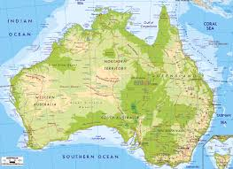
physical maps
Physical maps are maps that show physical landscape features
such as mountains, planes, rivers and lakes. these thing are shown
through labels.
RELIEF - shadowing to show were the rough terrain is located. The height
above sea level. Green on a physical map show the lower elevations.
Brown on a physical map shows the high elevations. Water is always shown in
blue.